Chuanshuoge
Friday, February 10, 2023
arcGIS raster 4
create mosaic dataset
add raster
raster property -> defaults tab -> increase max number per mosaic to 50
enhance -> color balance -> change surface type to first order
color corrected
optimize -> build overview
reference:
https://desktop.arcgis.com/en/arcmap/latest/manage-data/raster-and-images/ex-5-color-balancing-a-mosiac-dataset.htm
国内消费外币
Thursday, February 9, 2023
Miss Mina
Wednesday, February 8, 2023
What Financial Tortoise Do In Bear Markets
arcGIS raster 3
create a new mosaic dataset
add raster to mosaic dataset
right click on viewport -> properties -> set viewport as default method
customize -> drag and drop viewport on toolbar
view from north
adjust viewport -> same building view from the south
reference:
https://desktop.arcgis.com/en/arcmap/latest/manage-data/raster-and-images/ex-3-viewpoint-mosaic-dataset.htm
Tuesday, February 7, 2023
arcGIS raster 2
create a mosaic dataset
add raster input to mosaic dataset
create referenced mosaic
right click on referenced mosaic -> properties
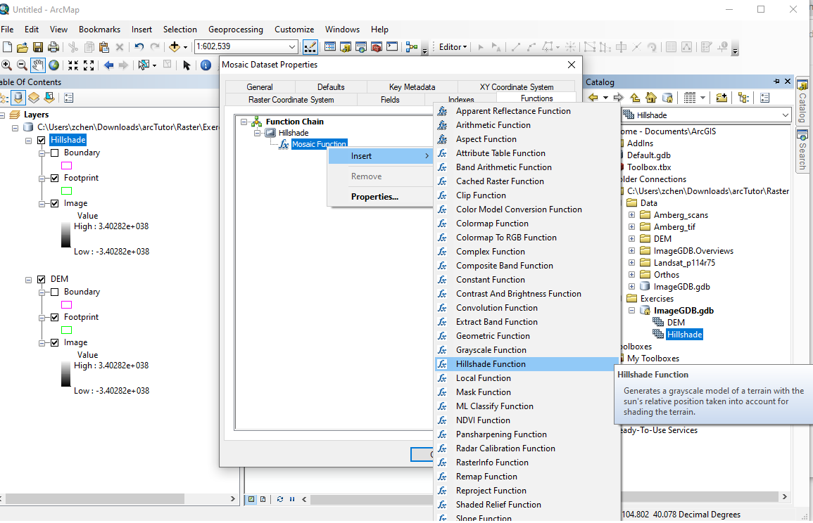
function tab -> insert -> hillside function
scale z factor
elevation is displayed
create another reference mosaic
select shade relief function
colored mosaic
reference:
https://desktop.arcgis.com/en/arcmap/latest/manage-data/raster-and-images/ex-2-creating-multiple-mds-from-a-md.htm
霍格華茲的傳承 Hogwarts Legacy
Newer Posts
Older Posts
Home
Subscribe to:
Posts (Atom)